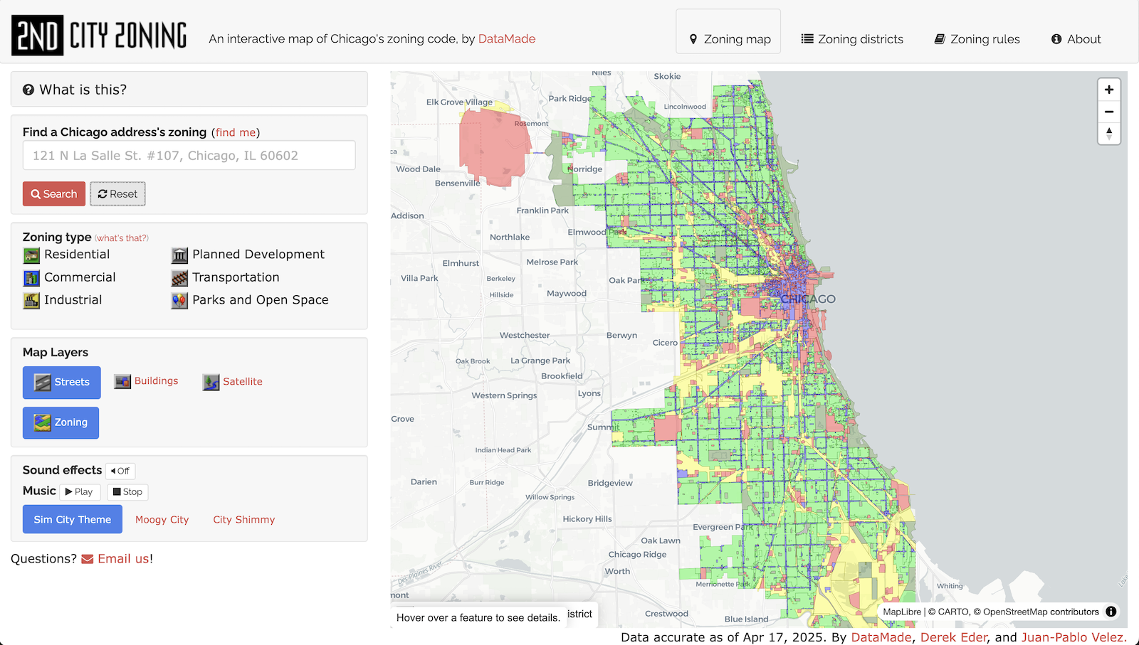
2nd City Zoning is an interactive map that lets you:
- find out how your building is zoned
- learn where to locate your business
- explore zoning patterns throughout the city
To make Chicago’s zoning code digestible by humans, we took inspiration from one of our favorite games: Sim City 2000. It started with the color scheme and from there we got a little carried away. Graphics, sounds, music, oh my.
2nd City Zoning is entirely open source and built with open data.
git clone [email protected]:datamade/second-city-zoning.git
cd site_template
gem install jekyll
jekyll serve -w
Then navigate to http://localhost:5000/
If you have Docker installed, can avoid some of the hassle of installing Jekyll and/or Ruby by pulling from the offical Jekyll image, installing dependancies, and serving locally.
This is especially handy if you're on Windows machine:
docker compose upThe City of Chicago publishes its latest Zoning information on an ArcGIS server. Here's the steps to update this site, which we do annualy:
- Setup and install
pyesridump - Run `esri2geojson https://gisapps.cityofchicago.org/arcgis/rest/services/ExternalApps/Zoning/MapServer/1 chicago-zoning.geojson
- Use
ogr2ogrto simplify the geometries and reduce the size. This can be done via the command line or with QGIS. We use a tolerance of0.00003 - Use https://open-innovations.github.io/geojson-minify/ to remove properties we don't use. We only make use of
zone_type,zone_class, andordinance_num gzipthe GeoJSON file and place in the/datafolder.
- Derek Eder
- Juan-Pablo Velez
- Monkruman St. Jules
If something is not behaving intuitively, it is a bug, and should be reported. Report it here: https://github.com/datamade/second-city-zoning/issues
- Fork the project.
- Make your feature addition or bug fix.
- Commit, do not mess with rakefile, version, or history.
- Send a pull request. Bonus points for topic branches.
Copyright (c) 2013-2025 Derek Eder and Juan-Pablo Velez of Open City. Released under the MIT License.